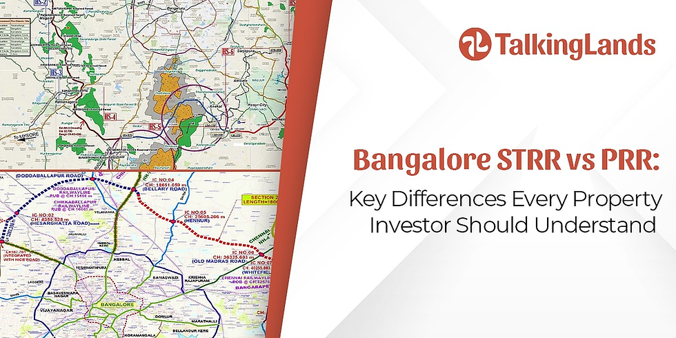
CDP Plan Bangalore 2031: Roads, Metro, and Connectivity Insights via TalkingLands
- Jan 19
- 8 min read
Updated: Apr 18

The Bangalore CDP 2031 is the city’s long-term plan for growth and transport. It sets rules for land use, road development, Metro lines, and public spaces. The goal is simple. Make the city easier to move around. Support growth. Improve daily life for residents.
The CDP Plan Bangalore 2031 also links development to transport. So, homes, jobs, roads, and Metro stations are planned together. This helps reduce traffic stress. It also guides how the Bangalore cdp 2031 zone areas develop in the future.
This article explains the plan in a clear language. No jargon. Just what you need to know.
What’s All in This Page
What the Bangalore CDP 2031?
Roads and ring road expansion
Metro growth and new lines
Suburban rail network
Bus upgrades and last-mile access
Walking and cycling plans
Timelines and funding
Why this plan matters
FAQs
What Is the Bangalore CDP 2031?
The Bangalore Comprehensive Development Plan 2031 is a long-term urban planning blueprint prepared by the Bangalore Development Authority to guide the city’s growth and infrastructure development up to 2031. It outlines land use zoning (residential, commercial, industrial, and green spaces), transportation networks, housing, and public amenities to ensure planned and sustainable expansion of Bengaluru. The plan also focuses on reducing congestion, improving connectivity, and balancing urban development with environmental conservation.
It covers:
Housing
Commercial zones
Green spaces
Industries
Major roads
Metro
Suburban rail
The idea is to prevent unplanned growth. So, the Bangalore infrastructure plan 2031 acts like a city roadmap.
A key focus is mobility. Traffic is a big stress in the city. The plan tries to spread development outward. This reduces pressure on the center. It also supports balanced growth across the Bangalore cdp 2031 zone regions.

Get the CDP Plan of 2031 by registering at insights.talkinglands.com
2015 vs 2031 CDP Plan Bangalore: what changed in the plan
Bangalore’s older statutory plan is RMP 2015. It focused on building a basic “ring + radial” road structure and pushing public transport like commuter rail and bus priority lanes.
The newer RMP/CDP 2031 draft expanded that idea. It talked about more ring roads, more radial roads, and more Metro coverage, including Metro routes planned along the PRR.
One important note for accuracy: recent reporting says the RMP-2031 was scrapped, and BDA has moved to preparing RMP-2041. So treat 2031 as the “draft direction” the city was planning around, not a final, enforced document.
2015 vs 2031: major transport and connectivity updates
Area | RMP 2015 (baseline direction) | RMP/CDP 2031 draft (what was added/expanded) |
Ring road structure | Proposed a network with Core Ring Road, Intermediate Ring Road, ORR, and a proposed Peripheral Road/PRR to reduce congestion. | Kept the ring-road approach but pushed two additional rings outside existing rings: PRR plus an intermediate ring between ORR and PRR. |
Peripheral Ring Road | PRR referenced as a major congestion-relief road, commonly described as ~116 km in planning documents. | PRR continued as a core element, with stronger emphasis on using it to decongest the city and structure growth. |
Radial roads | Radials existed as the main links from core to outskirts (often cited as 13 in later comparisons). | Proposed increasing radial roads from 13 to 26, to improve access to outer zones and distribute traffic. |
Metro direction | RMP 2015 integrated Metro as a planned rapid transit system while Phase 1 was still in progress (context noted in later plan documents). | Draft 2031 talked about Metro expansion more aggressively, including Metro routes along PRR. |
Commuter/suburban rail | Draft planning language highlighted commuter rail as a needed mass transit layer. | Draft 2031 kept multi-mode ideas and tied major circulation planning to big ring-road completion (PRR + Intermediate RR). |
Bus priority and bus lanes | Draft 2015 materials called out dedicated bus lanes along main axes. | Draft 2031 continued the public transport emphasis (often discussed alongside Metro + ring-road expansion). |
City plans change how land and infrastructure evolve over time. You can explore spatial layers and location context for Bangalore on TalkingLands to better understand how planning directions translate on the ground.
Roads and Ring Roads in the Bangalore Infrastructure CDP Plan Bangalore 2031
Road development is one of the biggest parts of the plan.
Peripheral Ring Road (PRR)
A 116 km Peripheral Ring Road is proposed. It circles the city outside the current Outer Ring Road.
This helps:
shift long-distance traffic away from city roads
reduce congestion inside
support new growth areas
It also connects highways and industrial zones.
More Major Corridors
The city will increase arterial corridors:
From 13 → 26 major radial roads
These roads connect outer areas to the city core.
Elevated Corridors
About 13 elevated road corridors are planned.
These aim to:
cut signal stops
reduce travel time
add smoother cross-city routes
Combined Metro + Road corridors
Some future routes may carry both:
Metro on top
road below
This saves land and reduces disruption.
The overall goal is simple. Spread traffic out. Avoid bottlenecks. Reduce daily commute stress.
Road proposals affect access, traffic flow, and development patterns. TalkingLands helps you view major corridors and surrounding areas through layered maps and location data.

Get Combined Metro + Road corridors in the Bangalore via insights.talkinglands.com
Steps to Check CDP Plan Bangalore 2031 Using TalkingLands
TalkingLands makes it easier to understand zoning, infrastructure corridors, and planning layers related to the Bangalore CDP 2031. Instead of manually reading large planning documents, you can check location-level insights in a structured way.
Step 1: Visit the TalkingLands Platform
Go to the TalkingLands insights portal.
Step 2: Create an Account and Get 5000 Tokens Free
Sign up on the platform to create your account.
Once registered, you receive 5000 free tokens to explore planning layers, zoning details, and infrastructure insights.
Creating an account allows you to:
Access CDP 2031 layers
Unlock zoning intelligence
View infrastructure overlays
Generate location-based reports
Step 3: Search Your Property Location
Enter the:
Location name or move map
Or simply move and zoom the map to your desired area.
This helps you pinpoint the exact parcel in Bengaluru.
Step 4: Activate the CDP 2031 Layer
Enable the CDP / RMP planning layer to view:
Zoning classification
Land-use category
Transport overlays
Growth corridors
This gives clarity on how the area was structured under the planning framework prepared by the Bangalore Development Authority.ured under the planning framework prepared by the Bangalore Development Authority.
Metro Expansion in the Bangalore CDP Plan Bangalore 2031
The Bangalore CDP 2031 supports large Metro expansion. Metro is seen as the backbone of city mobility.
Key Metro additions include:
Blue Line to the airport
Phase-3 new corridors
Inner-ring Metro planning
Extensions to connect growing suburbs
More areas will get Metro stations. This means fewer people need to use cars or bikes for long trips.
Why Metro growth matters
faster travel
less pollution
safer roads
more predictable commute time
Metro also supports real estate growth along corridors. But the plan tries to balance this with zoning rules in the Bangalore cdp 2031 zone map.
Bengaluru Suburban Rail Network
Suburban rail connects outer towns and city edges. It supports people who travel long distances daily.
The plan integrates suburban rail with Metro and bus systems. So people can switch modes easily.
This helps:
reduce car dependency
support affordable housing in outer zones
distribute jobs across more regions
It also reduces pressure on central Bangalore.
Bus Network and Last-Mile Connectivity
Buses remain the main mode for most people. The Bangalore infrastructure plan 2031 proposes:
more buses
better routes
bus priority lanes
neighborhood feeder services
Feeder buses help people reach Metro and suburban stations.
The plan also supports:
modern ticketing
grouped transit hubs
smoother transfers
The goal is simple. Make switching from bus → Metro → suburban rail easy and predictable.
Walking and Cycling in the CDP Plan Bangalore 2031
The plan also looks at people who walk or cycle. Today, many areas lack footpaths or safe crossings.
Key proposals include:
wider footpaths
safer crossings
cycle tracks
better lighting
walkable Metro station zones
This makes everyday travel safer. It also improves public health and air quality.
Walking and cycling support low-cost mobility. This matters in a growing city.
Capital Investment Highlights (Project-wise)
Project | Capital Investment |
Double-Decker Metro + Road Corridor | ₹25,311 Cr |
Elevated Road Corridors (13 corridors) | ₹18,204 Cr |
Suburban Rail Ring (proposed) | ₹21,000 Cr |

Timelines and Delivery
Most major projects target completion by or before 2031. Work depends on funding, approvals and execution capacity.
Funding comes from:
state government
central schemes
Loans
PPP models
Agencies involved include planning, Metro, road and transport authorities. Coordination is important because different systems must connect smoothly.
Large infrastructure projects move in phases and across agencies.TalkingLands helps users track location-level context alongside broader planning announcements.
Why the Infrastructure CDP Plan Bangalore 2031 Matters
This plan shapes how the city feels and functions.
Here’s what may improve:
travel time
access to jobs
quality of housing locations
real-estate value stability
city productivity
air quality
Better networks reduce stress and wasted hours in traffic.
The plan also creates more transit-oriented development. This means housing and offices grow near stations. So people can walk more and drive less.
It also helps developers, investors, and residents understand where growth will happen.
Impact on Zoning and Land Use
The Bangalore cdp 2031 zone structure defines:
residential zones
commercial corridors
mixed-use areas
transport corridors
green buffers
This creates clarity for:
Homebuyers
real-estate developers
Businesses
planners
It reduces guesswork. And it supports sustainable development around transport nodes.

Get insights on Impact on Zoning via insights.talkinglands.com
Why TalkingLands Tracks These Changes
TalkingLands works with spatial planning and location intelligence. Understanding the Bangalore CDP 2031 lets users:
study future development
analyse zoning
evaluate property risk
plan investment strategy
And it helps residents stay informed about the city they live in.
Final Summary
The CDP Plan Bangalore 2031 is a long-term urban plan. It links roads, Metro, suburban rail, buses and walking networks into one system. The aim is simple. Build a city that moves better. Reduce congestion. Support balanced growth. Improve daily life for people who live and work here.
The Bangalore infrastructure plan 2031 tries to shift development outward. It also builds strong public transport networks. This sets the foundation for the city’s next phase of growth.
TalkingLands continues to follow these changes. Understanding planning helps you make informed location and property decisions.
Urban plans set direction, but location context explains impact. Explore TalkingLands real estate data to see how infrastructure, zoning, and geography interact across Bangalore.
Frequently Asked Questions
1. What is the Bangalore Comprehensive Development Plan 2031?
It is the Revised Master Plan that guides land use, infrastructure, and transport development in Bengaluru up to the year 2031.
2. Who prepares the CDP 2031?
The plan is prepared and implemented by the Bangalore Development Authority.
3. How does Metro expansion help the city?
Expansion of the Namma Metro connects more residential and job zones, reducing road traffic and improving commute time.
4. What is the Peripheral Ring Road (PRR)?
It is a proposed 116 km ring road around the city designed to reduce congestion within core urban areas.
5. How does CDP 2031 impact real estate growth?
Zoning regulations and transport corridors influence where residential and commercial development can expand.
6. What are the key zoning categories in the plan?
The plan divides land into residential, commercial, industrial, public/semi-public, and green zones for organized development.
7. How does the plan improve infrastructure?
It focuses on upgrading roads, drainage systems, water supply, and public utilities to support future population growth.
8. Does CDP 2031 address traffic congestion?
Yes, it includes projects like new ring roads, metro expansion, and road widening to ease traffic issues.
9. How does the plan support sustainable development?
It emphasizes protecting lakes, green belts, and open spaces while promoting eco-friendly urban growth.
10. Why is CDP 2031 important for residents and investors?
It provides a clear roadmap for future development, helping residents understand city growth and guiding investors on high-potential areas.